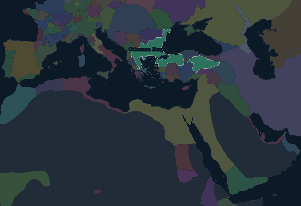
1400: a Balkan and Anatolian power
The dynasty takes its name from Osman I, who led a principality, or beylik, in north-west Anatolia on the frontier with the Byzantine Empire around 1300. His son Orhan took Bursa in 1326, and in 1354 the Ottomans crossed into Europe at Gallipoli. They took Edirne (Adrianople) around 1369 and made it their capital. Victories at Kosovo in 1389 and Nicopolis in 1396 left them the dominant power in the Balkans.
By 1400 Sultan Bayezid I ruled from the Danube to central Anatolia, with Constantinople cut off inside his lands. Two years later Timur defeated and captured him at Ankara, and the state nearly fell apart in the succession war that followed.
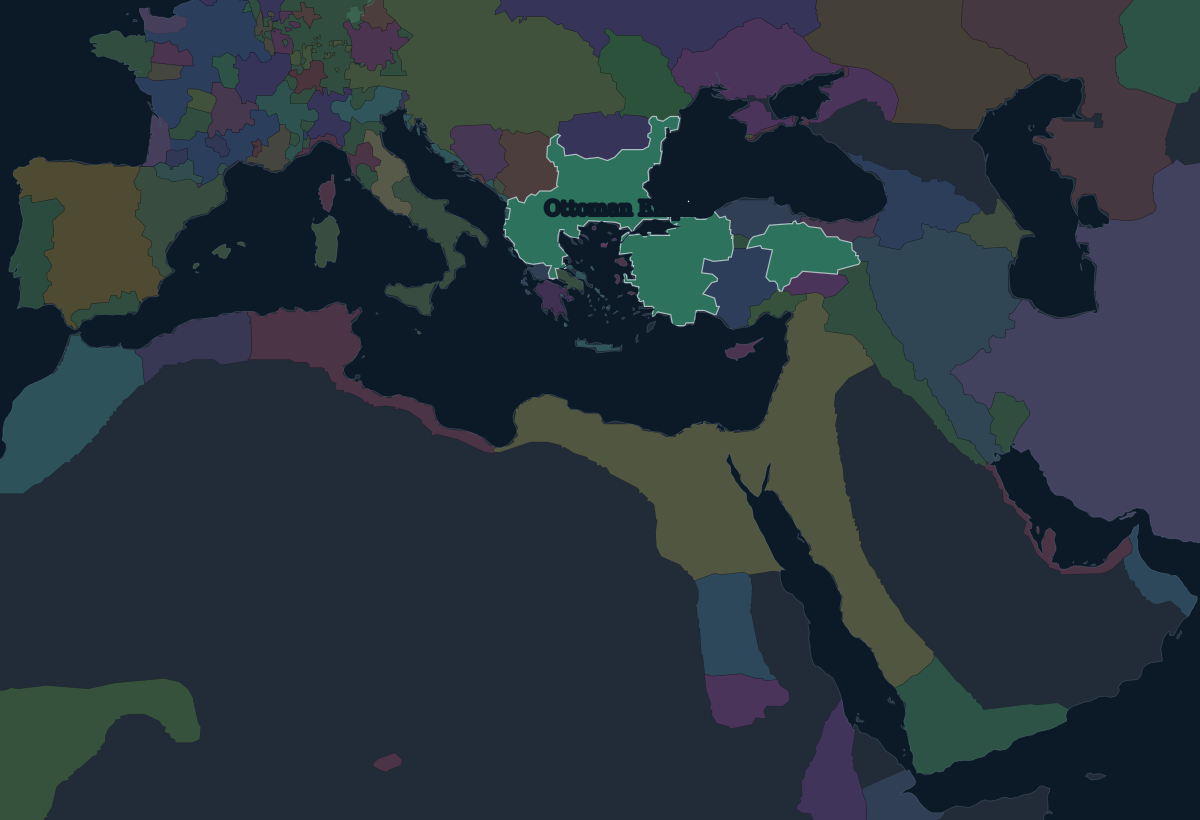
1453: Constantinople
After it recovered, the empire went back to the city it surrounded. On 29 May 1453 Mehmed II took Constantinople after a siege of nearly two months, ending the Byzantine Empire, the last continuation of the Roman state. The city, later known as Istanbul, became the Ottoman capital.
1566: Suleiman the Magnificent
The empire's largest gains came in two reigns. Selim I defeated Safavid Persia at Chaldiran in 1514, then destroyed the Mamluk Sultanate in 1516–1517. That brought Syria, Egypt and the holy cities of Mecca and Medina under Ottoman rule. His son Suleiman took Belgrade in 1521 and Rhodes in 1522, and crushed the Hungarian army at Mohács in 1526. He besieged Vienna in 1529, took Baghdad in 1534 and annexed central Hungary in 1541.
Suleiman died in 1566 while besieging Szigetvár in Hungary. By then the empire controlled most of the Mediterranean coast from Algiers to the Adriatic, and the Black Sea, the Red Sea and the Persian Gulf.
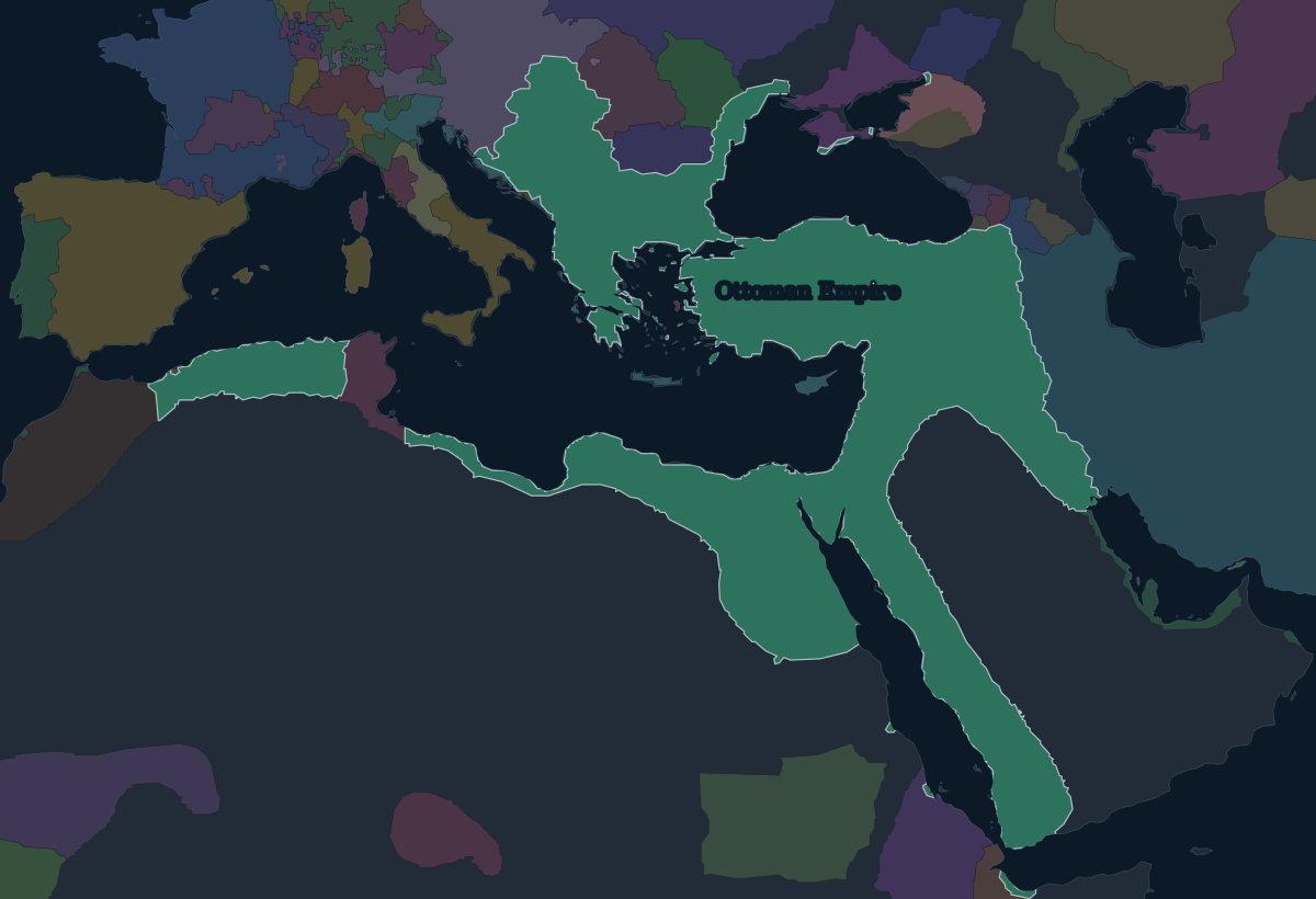
1683: the gates of Vienna
The empire reached its furthest point in Europe in the 1670s, after taking Podolia from Poland–Lithuania. In 1683 Grand Vizier Kara Mustafa Pasha besieged Vienna a second time. On 12 September a relief army under the Polish king Jan III Sobieski broke the siege. In the long war that followed, the Holy League drove the Ottomans out of Hungary, and the Treaty of Karlowitz in 1699 was the first major peace in which the empire gave up territory.
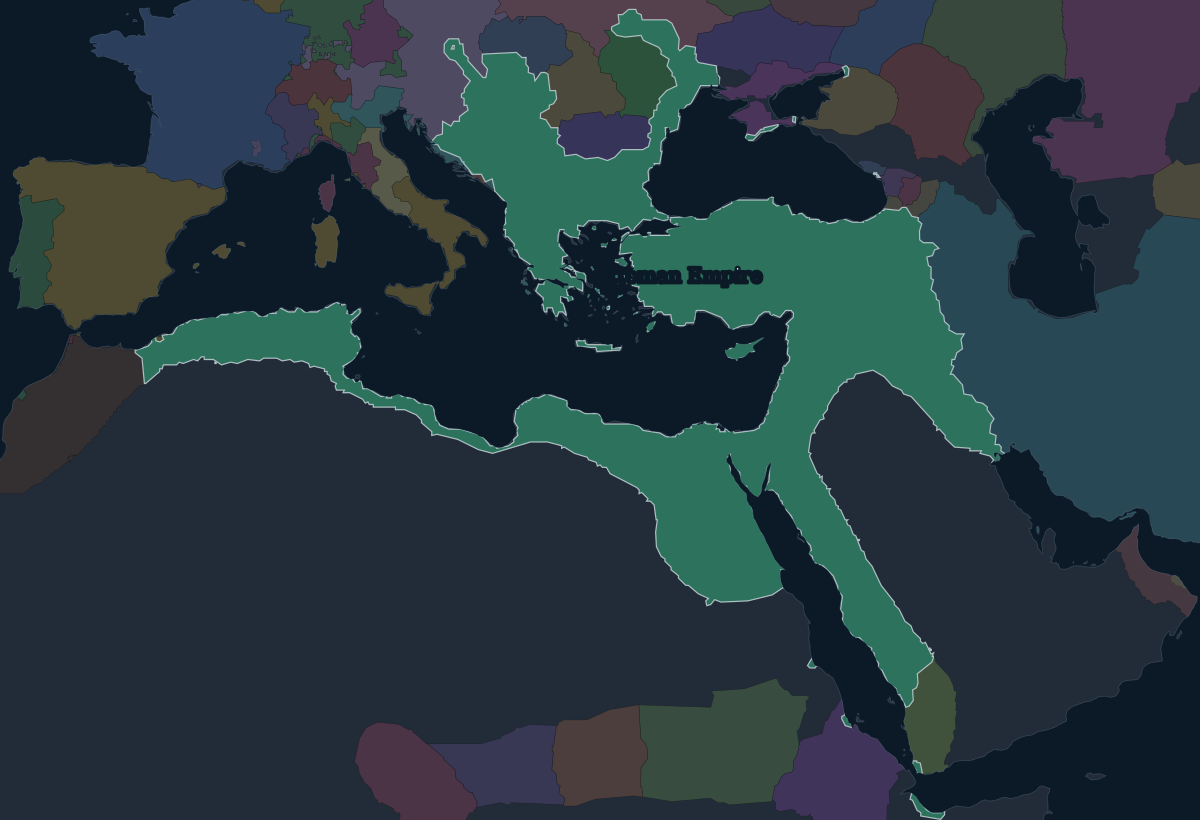
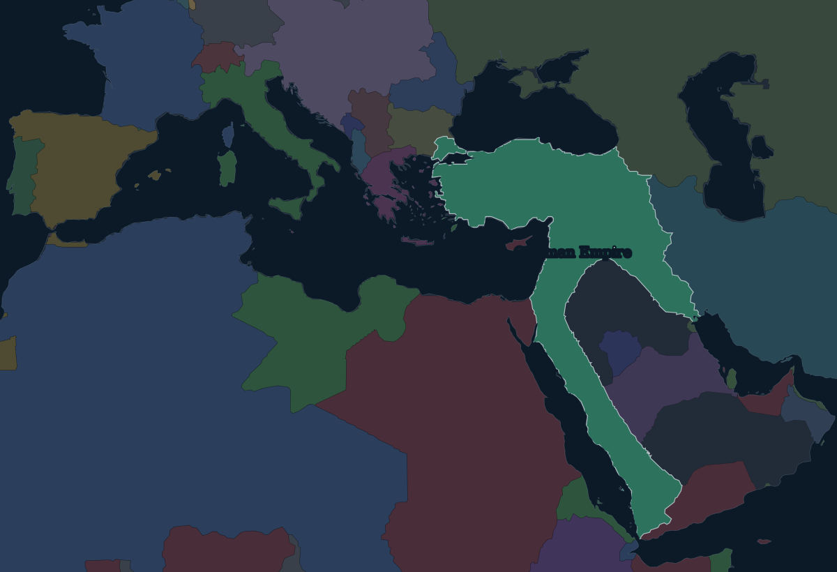
1914: the last decade
The nineteenth century was a long retreat. Greece won its independence in the 1820s. Egypt became autonomous under Muhammad Ali and his successors, and Serbia, Montenegro and Romania became independent at the Congress of Berlin in 1878. Italy took Libya in 1911–1912, and the Balkan Wars of 1912–1913 cost almost everything left in Europe except the land around Istanbul and Edirne.
The empire of 1914 was still large: Anatolia, Syria, Mesopotamia and the Hejaz along the Red Sea. It joined the First World War on the side of Germany that autumn. Defeat in 1918 led to partition and to the Turkish War of Independence. The sultanate was abolished in 1922, the Republic of Turkey was proclaimed in 1923, and the caliphate was abolished in 1924.