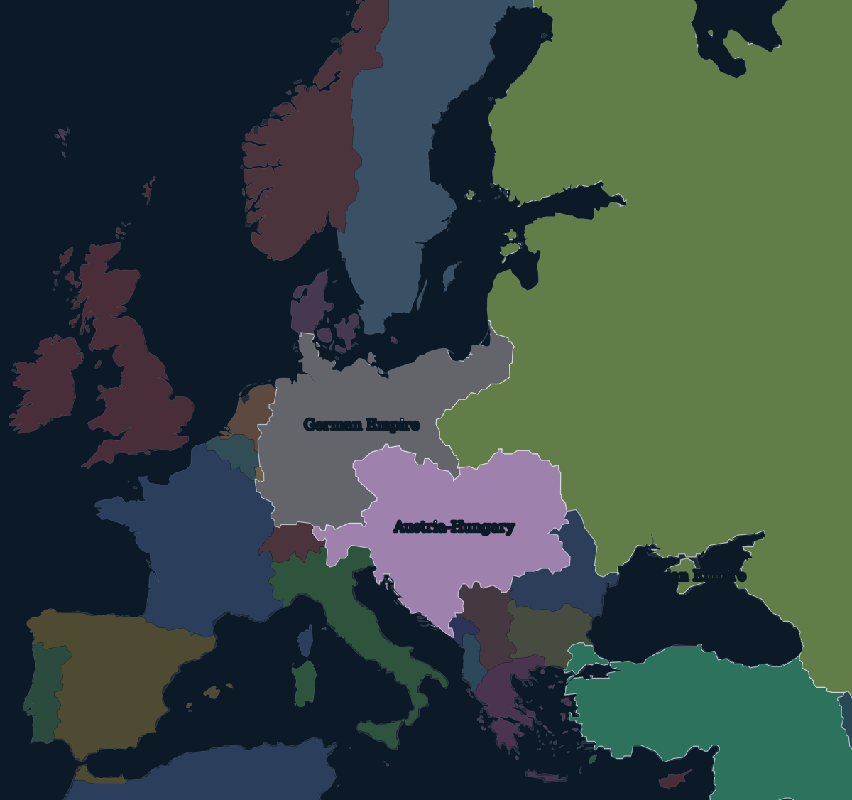
1914: a continent of empires
On the eve of the war, the German Empire stretched from Alsace-Lorraine to East Prussia.Austria-Hungary ruled a dozen nationalities from Bohemia and Galicia to Bosnia and Transylvania. The Russian Empire included Finland, the Baltic provinces and most of Poland. After the Balkan Wars, the Ottoman Empire had only a corner of Europe left around Istanbul and Edirne.
On 28 June 1914 the heir to the Austro-Hungarian throne, Archduke Franz Ferdinand, was assassinated in Sarajevo. Within seven weeks Germany and Austria-Hungary were at war with Russia, France, Britain and Serbia.
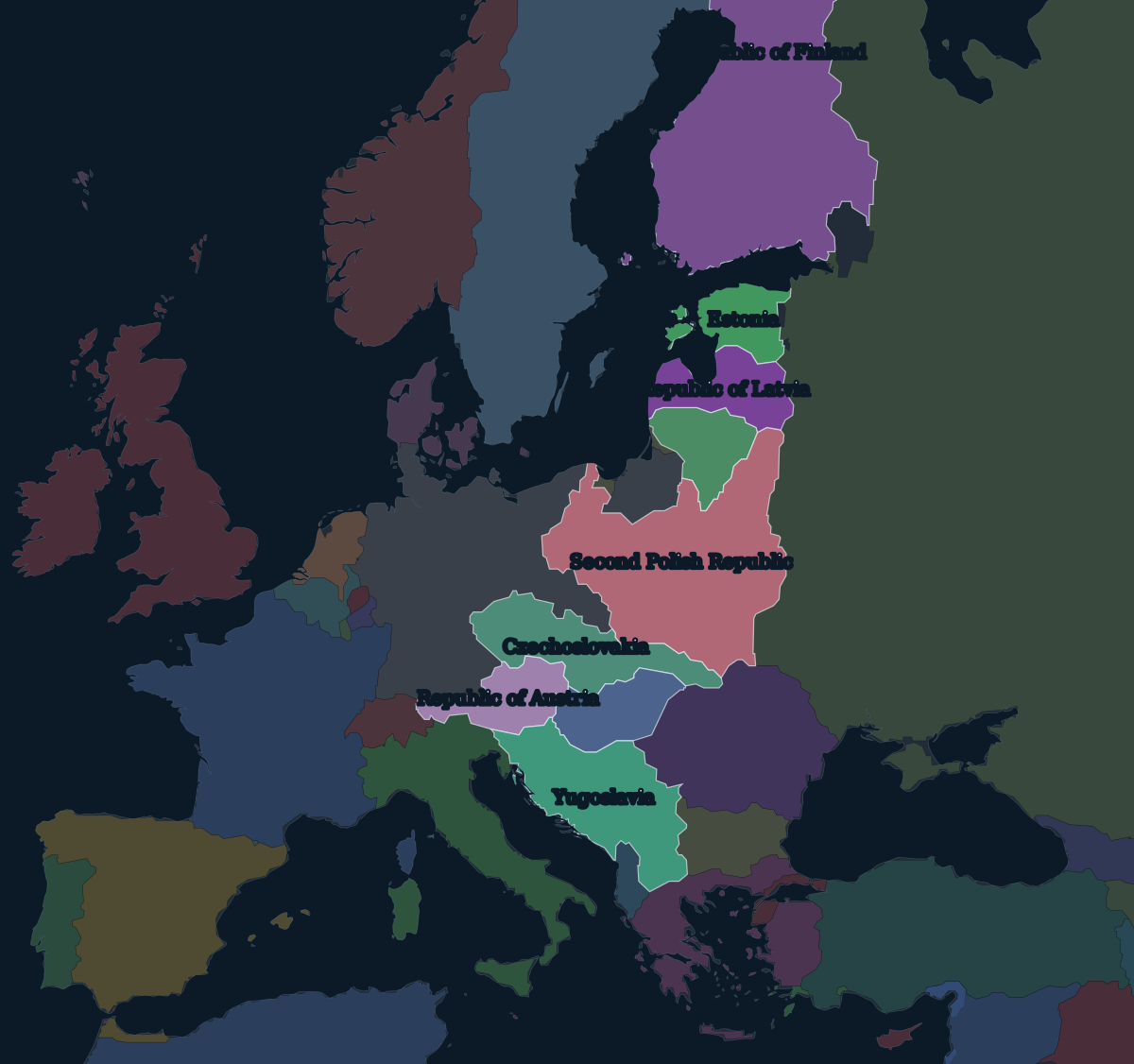
1920: the new map
None of the four empires outlasted the war. The Russian Empire collapsed in the revolutions of 1917, and the Bolsheviks gave up its western lands at Brest-Litovsk in March 1918. Austria-Hungary broke apart in October and November 1918 as its nationalities declared independence, and the German emperor abdicated on 9 November, two days before the armistice.
The peace treaties of 1919–1920 then drew the new borders: Versailles with Germany, Saint-Germain with Austria, Neuilly with Bulgaria, Trianon with Hungary and Sèvres with the Ottoman Empire. Along the old imperial borderlands there was now a belt of states:
Finland, Estonia, Latvia and Lithuania on the Baltic. Poland, independent again for the first time since the partitions of the 1790s.Czechoslovakia. The Kingdom of Serbs, Croats and Slovenes, renamed Yugoslavia in 1929 and shown under that name on the map. And Austria and Hungary, now two small separate states. Hungary lost about two-thirds of its former territory at Trianon. Romania doubled in size, Italy gained South Tyrol and Trieste, and Germany lost Alsace-Lorraine to France and the Polish Corridor to Poland.
The map of 1920 was not final. The Polish–Soviet War went on until 1921, the Turkish War of Independence overturned Sèvres, and the Irish Free State was established in 1922. Many of these borders would be redrawn again, by force, twenty years later.