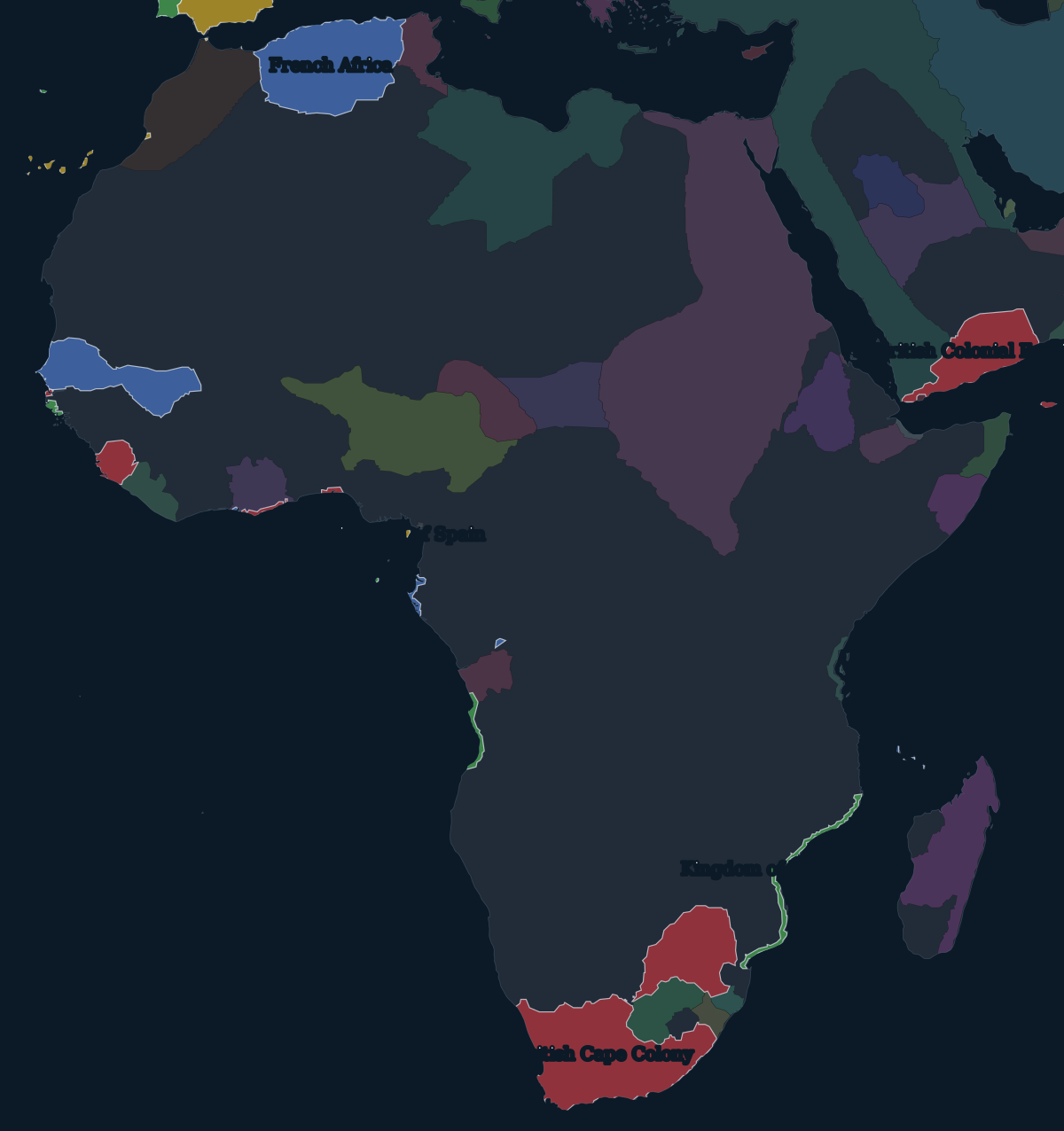
1880: coasts and footholds
European rule in Africa in 1880 was mostly coastal. France had held Algeria since 1830 and controlled the lower Senegal. Britain had the Cape Colony and Natal in the south and trading colonies in West Africa: the Gambia, Sierra Leone, the Gold Coast and Lagos. Portugal claimed far more than it governed in Angola and Mozambique. Inland, the continent was ruled by African states, among them the Sokoto Caliphate, Asante, Ethiopia, Buganda and the Merina kingdom of Madagascar, and by many smaller polities and peoples.
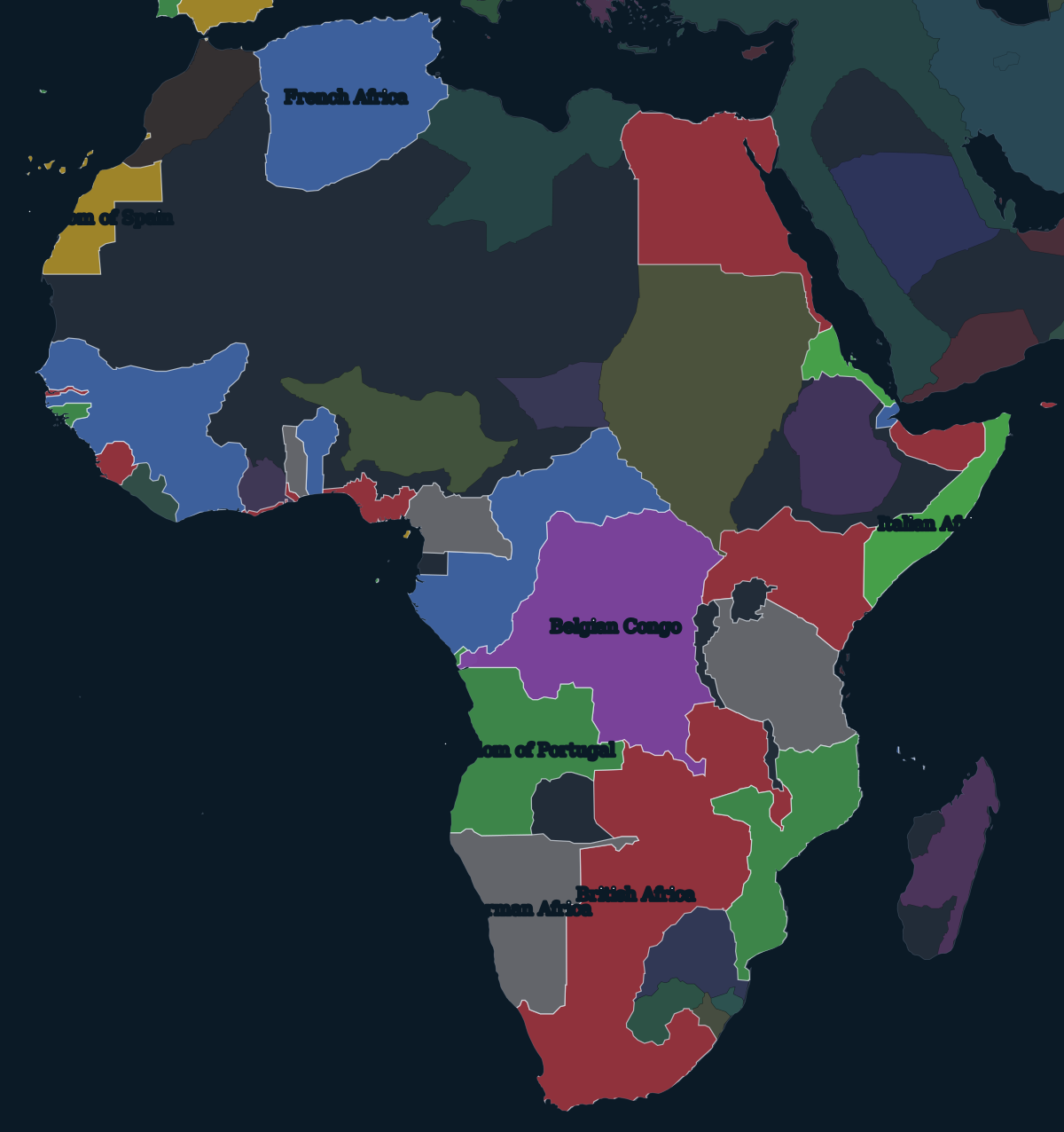
1895: the partition after Berlin
The pace changed in the early 1880s. France made Tunisia a protectorate in 1881, Britain occupied Egypt in 1882, and King Leopold II of Belgium was building a private colony in the Congo basin. In 1884 Germany claimed South West Africa, Togo and Cameroon, and German East Africa followed in 1885.
The Berlin Conference of 1884–1885 set the rules for the rest: a claim on the coast had to be backed by "effective occupation", and Leopold's Congo Free State was recognised as his personal possession. (The map labels it with its later name, the Belgian Congo, which it took when Belgium annexed it in 1908.) No African ruler was represented at the conference. Over the following decade, treaties between European capitals drew most of the borders shown on this map, often along rivers, lines of latitude and straight lines across land that none of the negotiators had seen.
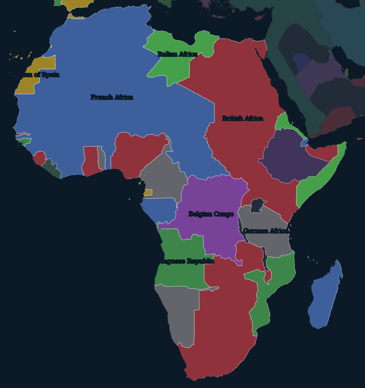
1914: two independent states
Conquest on the ground took longer than drawing lines, and it was resisted throughout. Samori Touré fought the French in West Africa until his capture in 1898. Ethiopia defeated an Italian invasion at Adwa in 1896 and kept its independence. In German South West Africa, the colonial army's war against the Herero and Nama from 1904 to 1908 became a genocide. The Maji Maji rising in German East Africa (1905–1907) was put down with a famine policy that killed far more people than the fighting did.
Britain defeated the Boer republics in 1899–1902. Italy took Libya from the Ottoman Empire in 1911–1912, and in 1912 France and Spain divided Morocco into protectorates. By 1914 only Ethiopia andLiberia were independent. Most of the borders drawn in this period became the borders of the states that won independence from the late 1950s onward.