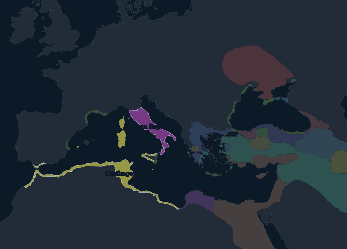
264 BCE: Italy, and a war over Sicily
By the 260s BCE the Roman Republic had brought the Italian peninsula south of the Po valley under its control, the last of it after the war with Pyrrhus ended in 275 BCE. Its rival was Carthage, the Phoenician city in what is now Tunisia, whose trading empire held the coast of North Africa, southern Spain, Sardinia, Corsica and western Sicily.
The First Punic War began in 264 BCE over the Sicilian city of Messana. Rome won Sicily, its first province overseas, in 241 BCE, and soon took Sardinia and Corsica too. In the Second Punic War (218–201 BCE), Hannibal crossed the Alps into Italy, but the war ended with Carthage confined to Africa and its Spanish lands in Roman hands. A third war ended with the destruction of Carthage in 146 BCE.
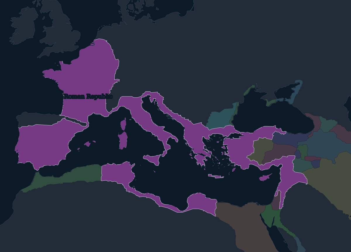
44 BCE: the Republic at Caesar's death
Over the next two centuries the Republic took Greece and Macedonia, much of Spain, the province of Asia in western Anatolia, and, under Pompey in the 60s BCE, Syria and the eastern Mediterranean coast. Julius Caesar's conquest of Gaul (58–50 BCE) pushed the frontier to the Rhine and the English Channel.
By the time Caesar was assassinated on the Ides of March, 44 BCE, Rome governed almost every Mediterranean coast except Egypt, but the Republic's institutions had been broken by civil war. After Octavian defeated Antony and Cleopatra at Actium in 31 BCE and annexed Egypt, he ruled alone, and from 27 BCE as Augustus, the first emperor. The map marks the change from republic to empire at Actium.
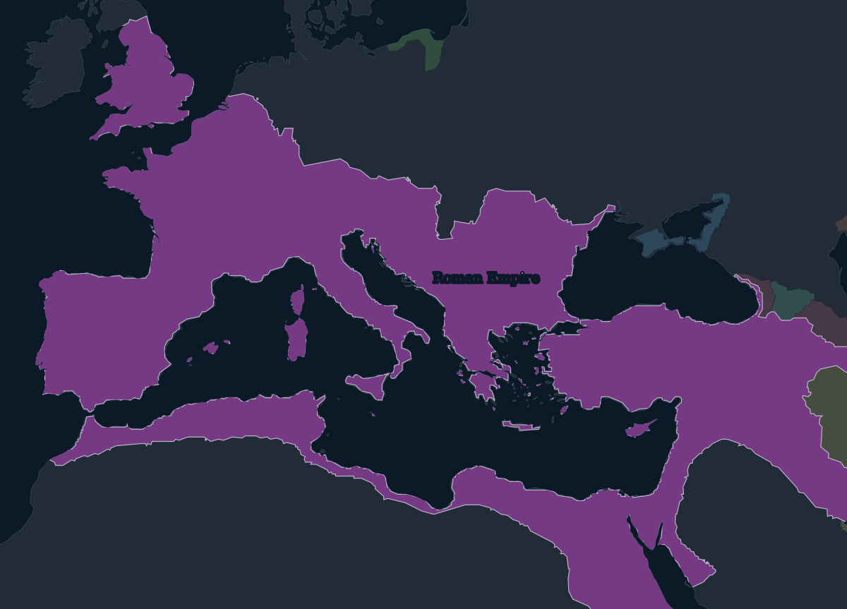
117 CE: the empire at its greatest extent
The empire reached its greatest size under Trajan, who died in 117 CE. Southern Britain had been conquered from 43 CE. Trajan added Dacia, north of the Danube in modern Romania, and the Nabataean kingdom in Arabia, both in 106. In 114–117 he took Armenia and Mesopotamia from Parthia.
His successor Hadrian gave up the new eastern provinces almost at once and fortified the frontiers instead: Hadrian's Wall in northern Britain dates from 122. For the next century the borders barely moved. Then came the crisis of the third century, when the empire briefly split into three: from 260 a breakaway Gallic Empire held the west, and from 270 the Palmyrene Empire under Zenobia held the east, until Aurelian reunited them in 273–274.
395 CE: East and West
The empire had long been too large to govern from one place. Diocletian divided authority among several emperors from 293, and Constantine founded a new capital, Constantinople, in 330. When Theodosius I died in 395 the empire was divided between his sons, Arcadius in the east and Honorius in the west, and it was never ruled as one again.
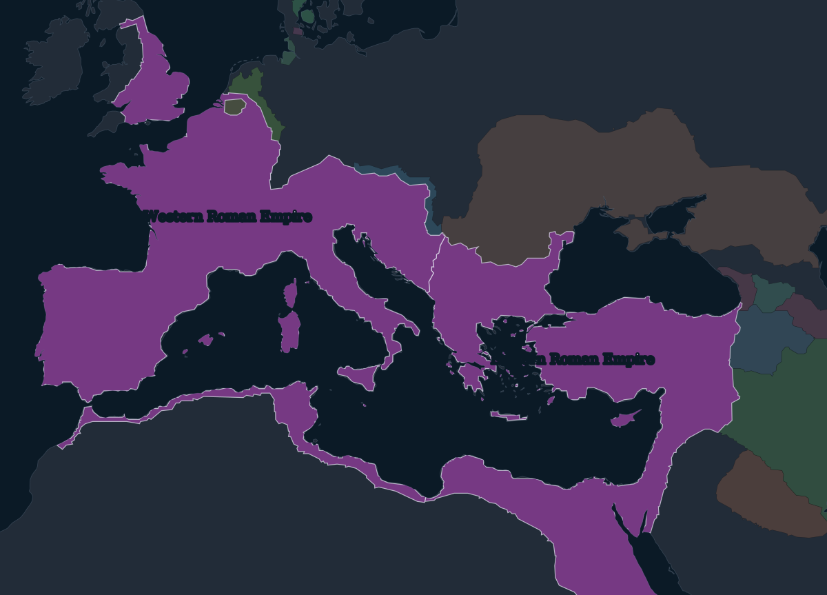
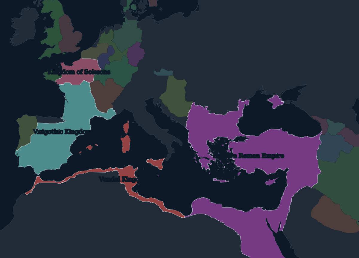
480 CE: the end in the west
The western half fell apart within a lifetime. The Visigoths sacked Rome in 410 and settled in southern Gaul and Spain. The Vandals crossed into Africa and took Carthage in 439, which cost the west its richest provinces. In 476 the general Odoacer deposed the boy emperor Romulus Augustulus and did not appoint a replacement. Julius Nepos, the last western emperor recognised in Constantinople, died in 480.
The map of 480 shows the result: Visigothic and Vandal kingdoms where Roman provinces had been, and in northern Gaul the Kingdom of Soissons, a Roman rump state that the Frankish king Clovis took in 486. Odoacer's Italy is a gap in the source data at this date. The Eastern Roman Empire, which historians call the Byzantine Empire, lasted almost another thousand years, until the Ottoman conquest of Constantinople in 1453.